The last car with a memorial ribbon on its antenna cleared Drake sometime around dusk on July 31. For the two days before that, Highway 34 through the canyon carried a slow, quiet weight of people, and residents who have lived here through any part of the last fifty years know exactly what that weight felt like. Then the ribbon cars left. The trailhead lots at Storm Mountain thinned out. The Big Thompson kept doing what it always does in early August, which is to run cold, low, and full of trout that most of the summer's visitors never saw feed.
If you live in Drake, this is the stretch of the calendar where the canyon becomes yours again. Not the postcard canyon, and not the anniversary canyon. The one you moved here for.
The Week That Just Ended
The Big Thompson Flood Memorial group's evening service at the Drake firehouse this year was the visible piece of something the whole canyon has been carrying for months. Larimer County hosted a remembrance ceremony at the Pulliam Community Building in Loveland in the afternoon, the Big Thompson Flood Memorial group's evening service ran at the Drake firehouse, and the Loveland Museum opened a new retrospective exhibit on the flood, capped with a public reception that night. Earlier that day, the Colorado Climate Center's symposium in Estes Park brought together researchers, emergency managers and local stakeholders.
If you missed any of it, the Loveland Museum retrospective is still hanging. Worth the forty minutes down-canyon on a weekday morning, when the drive itself is empty.
The 1976 event still sets the reference line for how hard a Front Range summer storm can hit a narrow canyon. Everything about how Drake reads the sky in August comes from that reference line.
The numbers are worth carrying with you as a resident, not as a scare. An intense thunderstorm parked over the canyon that night in 1976 and unloaded as much as 7.5 inches of rain in about an hour. The burst of water tore into the channel, shoving massive boulders aside and flattening buildings along the way, and at the canyon mouth, the Big Thompson River surged to more than 31,000 cubic feet per second. That is roughly two hundred and fifty times what the river is running at this week.
What The River Is Actually Doing Right Now
Late August is when the Big Thompson quietly becomes one of the more forgiving fisheries on the Front Range for anyone who lives inside a fifteen-minute drive. The tailwater below Lake Estes and the canyon water off Highway 34 fish differently enough that they might as well be two rivers, and knowing which is which is the kind of small edge that separates locals from weekenders.
In late June the tailwater below Lake Estes was flowing at around 120 cfs, while the water above stayed up in the 200 cfs range. At the tailwater, nymphing tends to be the play, with bigger rigs like leeches, caddis larvae, and hot-head patterns on point dropping to pheasant tails, zebra midges, Barr's emergers, and perdigons. Down in the canyon off US 34, a dry-dropper rig is generally the best for searching water. By this point in August those flows have dropped further and cleared up further, which is exactly the setup for evening dry-fly work.
| Stretch | Character in late August | What to reach for |
|---|---|---|
| Tailwater below Lake Estes | Low, clear, technical | Small nymph rig, midge-heavy |
| Canyon on US 34, above Drake | Pocket water, boulder-broken | Dry-dropper with a terrestrial on top |
| Below Drake toward Loveland | Wider, warmer, thinner public access | Streamers early, dries at last light |
The upper canyon is where clear pocket water rewards a small dry-dropper rig, spring and summer bring strong hatches of caddis, PMDs, BWOs, and stoneflies, wild brown trout are the main target with rainbows and the occasional cutthroat mixed in, and summer evenings can offer some of the best dry fly fishing on the river, especially in the soft edges and slower pools. The soft edges matter more in August than in July, because the fish have been pushed off the fast seams by two months of pressure.
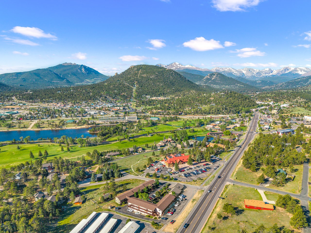
For anyone who has lived here a while and forgotten how much water is actually available on foot, the map is simple. The river offers nearly 10 miles of public access between Lake Estes and Drake, and below Drake the canyon widens and continues toward Loveland with another 10 miles of fishable water, though public access becomes more limited as you get closer to town. Twenty miles of trout water and no need to load the truck up before 6:30 p.m.
The Pocket Parks Nobody Fights You For In August
Most of the year, the four Larimer County parks in the canyon are an afterthought. Between now and the first hard freeze, they might be the best low-effort evening in Drake.
Established after the catastrophic flood of 1976, Larimer County acquired several parcels in the canyon and transformed four of them into public parks that provide river access for fishing, picnicking, and enjoying the great outdoors. The Big Thompson Canyon is a healthy ecosystem of Ponderosa Pine forests and sage shrublands with an array of wildlife including native trout. These parks are free to enter and are open from April to October, welcoming guests from sunrise to sunset.
The April-to-October window is the piece worth internalizing. You have roughly ten weekends left before the gates close for the season, and August evenings inside those gates are the ones where you can pull off the highway, set a chair on a gravel bar for an hour, and drive home before it's fully dark.
If you want a longer walk before the weather turns, the two closest options in the surrounding Roosevelt National Forest are still in shape. The 800,000-acre Roosevelt National Forest, which includes the 9,920-foot Storm Mountain, has various opportunities to recreate. The Storm Mountain multi-use trail for hikers and ATVers is a five-mile moderate route with a 1,289-foot elevation gain, and reviews note panoramic views of Rocky Mountain National Park, springtime wildflowers, and caution on the narrow roads getting there. Palisade Mountain is a 2.5-mile loop through the national forest to a 9,425-foot peak.
The River Forks Question
The other thing every resident is watching, and no one has a firm answer on, is what happens to the building at the fork.
There is no formal town center for Drake as a secluded gateway town. The historic stage stop building houses The River Forks Inn Bed & Breakfast along with Drake's lone restaurant; however, as of this writing, the property is closed while waiting for transition to new ownership. According to a January 2026 Facebook post, a future reopening is planned.
For anyone new to the canyon, that building is not just a restaurant. It is the reason people say they are going to Drake instead of driving through it. Its future ownership determines whether Drake continues to have a gathering room or becomes a place defined entirely by what happens on the river outside your own door. The January post is the most recent public word. There has not been a firmer update since, and residents comparing notes at the post office are pooling the same fragments the rest of us have.
A Word On The Sky, From A Neighbor
Every August afternoon in the canyon carries a small, real risk that non-residents underestimate. The anniversary week gave us all a refresher, but the physics do not change once the ribbons come down.
The 1976 storm was extreme but not outside the bounds of what nature can still throw at the Front Range. Big Thompson Canyon's steep walls and tight channel leave it vulnerable to short, brutal cloudbursts that can flip almost instantly into catastrophic flash floods. Retired USGS hydrologists and later analyses have stressed that similarly rare storms remain possible in Front Range drainages, and research shows that the most intense rainfall-driven flash floods in the Colorado Front Range are much more likely below roughly 7,500 feet, where heavy rain rather than snowmelt is usually responsible for the highest peak flows.
Drake sits well inside that band. That does not mean you should not fish the canyon parks in late August. It means you should read the sky at 2 p.m. before you commit to a 6 p.m. plan, and you should not park on a low bar if the anvil is already stacking over the ridge behind you.
What This Stretch Is For
The tourist calendar treats August as the tail end of the peak. For someone who owns a house here, it is the opposite. It is the two weeks where the canyon does its best impression of the version of Drake you moved for: low flows, warm evenings, quiet trailhead lots, the county parks still open, the highway carrying its normal Wednesday-afternoon volume instead of its ceremony-day volume. The River Forks question stays open. The river does not.
If your relationship with this canyon is changing, whether that means finally selling the cabin you inherited, adding a second place further up Storm Mountain, or helping a family member land here for the first time, the calm end of August is also the calm end of the market conversation before Labor Day resets it. When you're ready to talk through what your specific stretch of canyon is doing right now, New Roots Real Estate is a phone call away. Schedule a consultation whenever the light is right.